


The project "Investigation of the tufa barrier of Manojlovac waterfall using remote sensing" is focused on the development, application, and evaluation of modern remote sensing methods in the documentation, analysis, and monitoring of the state of the tufa barriers
The complexity, indentation, and sensitivity of tufa barriers, especially at the Manojlovac waterfall, require high-resolution, non-invasive, and spatially reliable monitoring methods, which this project enables.
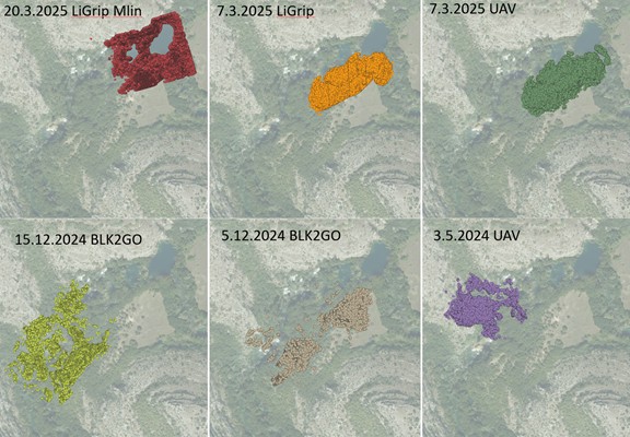
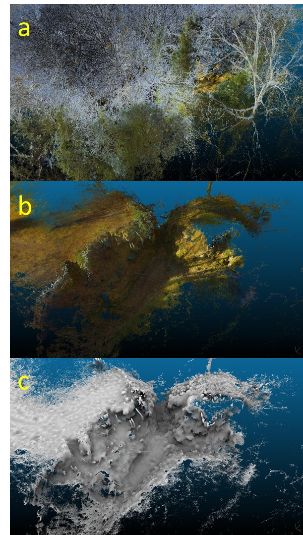
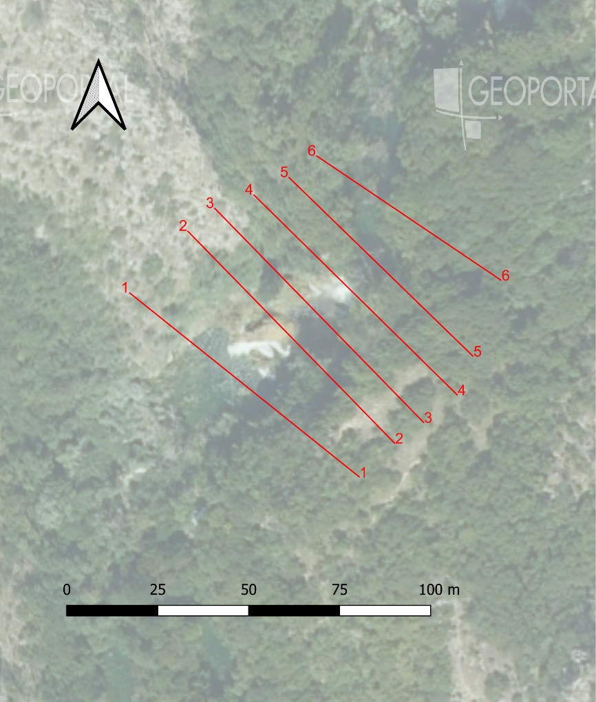
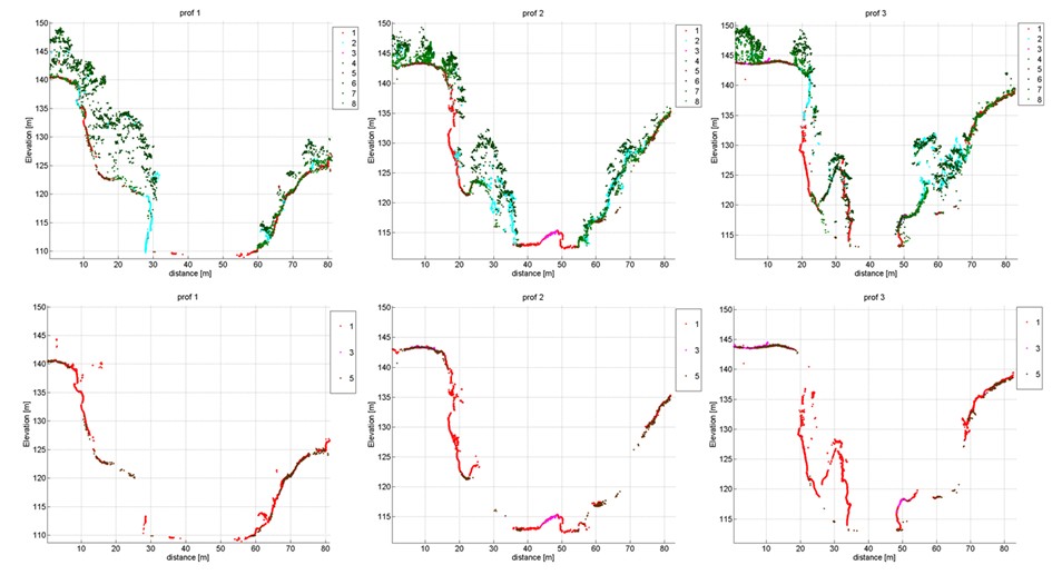
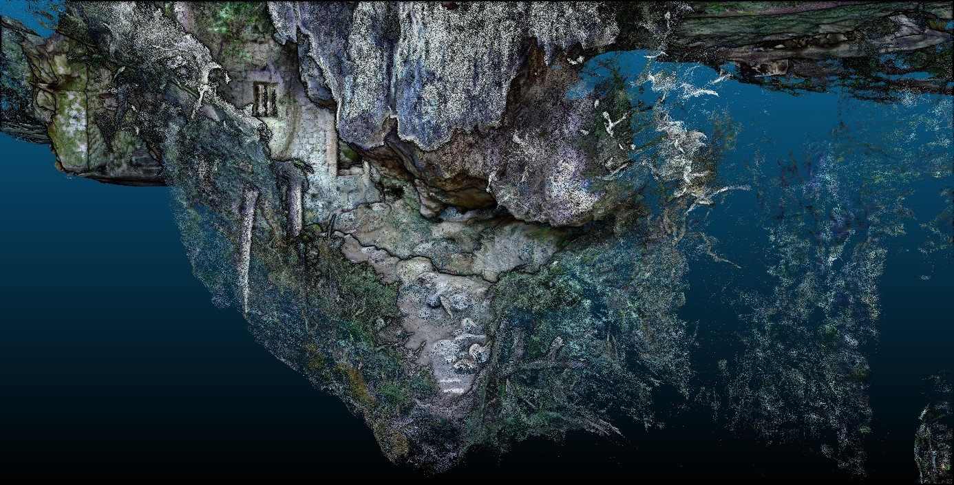
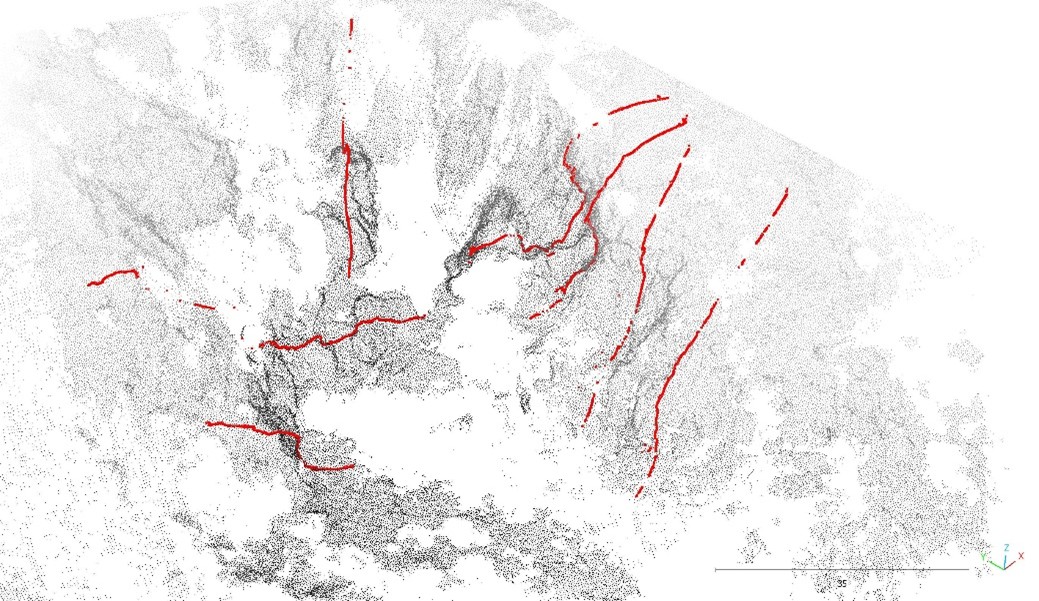
In the framework of the research, an integrated methodology was developed that combines UAV photogrammetry (RGB and multispectral imaging), manual and mobile laser scanning (SLAM technology – Leica BLK2GO and LiGrip 01 Lite), and Croatian state HR LiDar data. Each of these methods contributes to different aspects of the documentation: UAV allows for the documentation of a wider area and the surface morphology, SLAM reconstructs vertical, overhanging, and undercut parts of barriers and underground structures, while the HR LiDar provides a regional context and classified vegetation layers. By integrating all the sensor data, a detailed three-dimensional model of the Manojlovac waterfall has been created, with a spatial accuracy to the order of a centimeter. Additionally, within the framework of the project, the methodology of documenting and classifying vegetative cover on the basis of multispectral UAV images and LiDAR data was examined, with an emphasis on quantifying the influence of low and medium vegetation on the visibility and interpretation of tufa structures.
During the research (2024-2025), five field surveys were conducted in different seasonal and hydrological conditions. The results obtained include 3D models, clouds of point, cross-sections and longitudinal sections, vegetation cover maps, and a comparison of the applied methods. Through this comparison of these methods it was confirmed that none of them individually can provide a complete insight into the complex geometry of the barriers, while an integral approach enables the most reliable and complete reconstruction.
Morphological analyses of the Manojlovac waterfall have shown that its structure is multi-layered and extremely indented, characterized by vertical cliffs, deep undercuts (4–6 m), layered tufa slabs, fossilized segments, and active zones of deposit. The established 3D models have enabled the recognition of the impact of erosion on the documentation of cracks and collapsed surfaces.
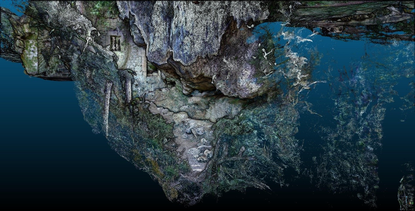
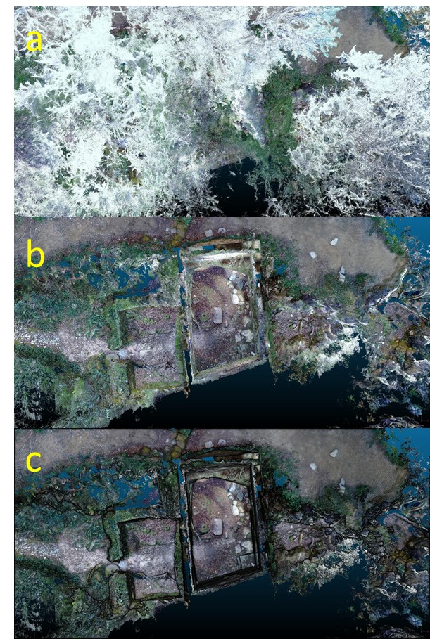
A particularly valuable contribution to the project was the documentation of the Krebić Mills complex, where a detailed 3D reconstruction of underground channels, above-ground ruins, and natural cave spaces integrated into the travertine system was created for the first time using SLAM technology.
This project represents a comprehensive step forward in documenting and understanding the tufa barrier system using modern remote sensing methods, while the results obtained provide a scientific basis and represent operational tools for the management, preservation, and protection of the natural phenomena of the Krka National Park.
Research
JOŠ NOVOSTI IZ KATEGORIJE
Assessing the status of the Middle Spotted Woodpecker and the European Nightjar in the broader area of the Krka NP
During 2026, the Zidarčac environmental firm conducted investigations into the Middle Spotted Woodpecker (Leiopicus medius) and the European Nightjar (Caprimulgus europaeus) in the broader area of the Krka National Park
The investigation and inventorizing of the entomofauna of forest habitats in the region of the Krka National Park
During 2025 and 2026, the Faculty of Forestry and Wood Technology of the University of Zagreb conducted entomofaunistic research in the most important forest communities in the Krka National Park to gain insight into the representation and condition of the insect fauna in the Park
A topographical map was created of potential speleological sites in the broader area of the Krka National Park
The underground world of karst is one of the most valuable components of the natural heritage of the Krka National Park, but also the most difficult to access
Investigation of the condition and composition of the macrozoobentos of the tufa barriers of the Krka River
During 2024 and 2025, an extensive scientific study of the composition and condition of macrozoobenthos (benthic invertebrates) was conducted on all seven tufa barriers of the Krka River